In 2015, the hottest year on record, heat waves killed hundreds of people, a glacier in Greenland lost a chunk of ice the size of Manhattan, and the wettest rainforest in the United States caught fire. 2016 is going be even hotter.

An Instagram account, Everyday Climate Change, documents what’s happening around the world visually, with photos of the causes and effects of global warming from every continent, including droughts, fires, and floods.
“I had been documenting the large-scale environmental consequences in East Asia as a result of the rapid development here,” says James Whitlow Delano, the Japan-based photographer who started the project in 2015. “The air in China had become thick enough to cut with a knife. The deserts there are expanding. Oil palm is leading to massive deforestation in equatorial Southeast Asia. Larger and larger storms are hitting coastal areas in the region, too. I felt that magnitude of the problem leading to climate change was not being addressed.”
Delano met one of the founders of Everyday Africa, another Instagram feed that shows a side of Africa that isn’t usually in the media. He was inspired to do something similar on climate, working with photographers around the world.
“I wanted to try to avoid making the feed a collection of Western or Northern photographers documenting climate change,” he says. “So, I have sought member photographers that are as varied as the regions they document.”
He’s also bringing the photos to real-life exhibits—so far, Milan, New York, Chicago, and Delhi and other Indian cities in August. “I feel that face-to-face
communication still leaves a more lasting, deeper impression,” he says. “I love to
see the light go on in students’ eyes when the message resonates.”
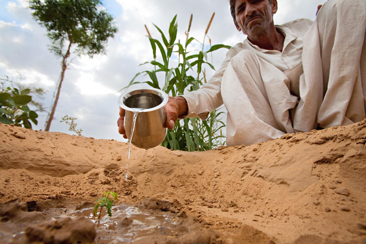
All Photos: via Everyday Climate Change
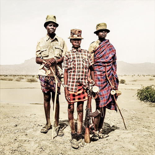
Ebei Edapal, Esekon Eipan, and Ebulon Louyongorot stand on the Todonyang plains near a watering hole in Kenya on February 11, 2014.
The teenage boys started carrying guns as early as seven years old to protect their herd from the frequent attacks of the rival Daasanach tribe.
With the changing climate the Turkana herdsmen, who traditionally practice a nomadic pastoralist lifestyle in the arid northwestern tip of Kenya, struggle to cope with the harsh consequences of the prolonged drought. Across the border in Ethiopia the Daasanach are pushing into Turkana territory as their government handed most of their traditional lands over to large-scale farming developers. Competing for the fishing grounds of Lake Turkana and the pastures around it, the rival communities are trapped in a vicious cycle of conflict as they struggle to survive.
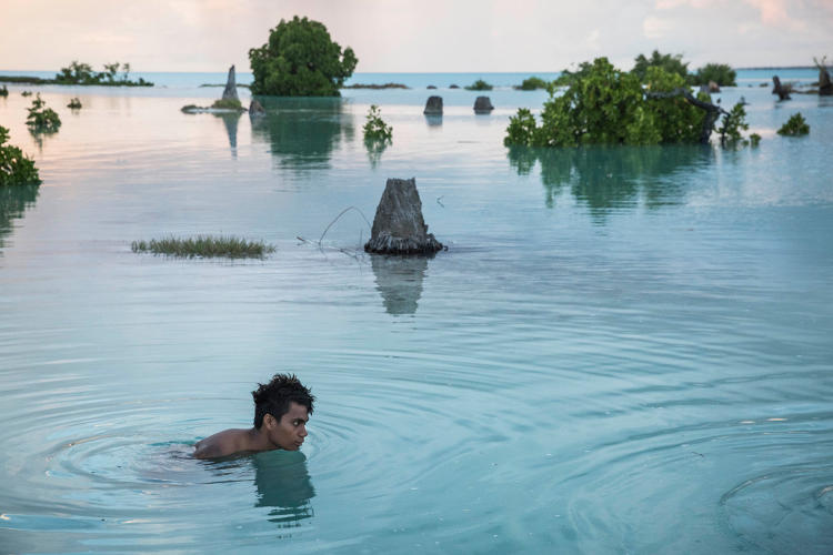
Peia Kararaua, 16, swims in the flooded area of Aberao village that is located in Tarawa atoll, Kiribati. Kiribati is one of the countries most affected by sea level rise. During high tide many villages become inundated, making large parts of them uninhabitable.
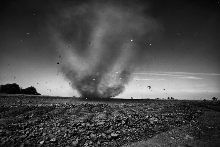
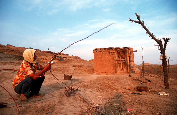
A “dust devil” whirls across the parched landscape outside of Stratford, a town reeling from California’s crippling drought. California is entering its fourth year of well below normal levels of rain and snow. The state’s agricultural heartland, the Central Valley, is being especially hard hit. Towns are abandoned, fields are parched, and people are fleeing the area.
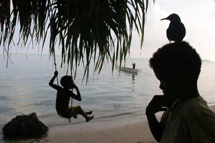
Children play on the beach, beside a fallen trunk of a coconut tree whose roots had been exposed by sea erosion of the land, on the shoreline of Han Island, Carterets Atoll, Papua New Guinea, on Monday, December 11, 2006. Rising sea levels have eroded much of the coastlines of the low-lying Carteret islands (situated 80 km from Bougainville Island, in the South Pacific), and waves have crashed over the islands flooding and destroying what little crop gardens the islanders have. Food is in short supply, banana and swamp taro crops are failing due to the salt contamination of the land, and the islanders live on a meager one-meal-per-day diet of fish and coconut. There is talk by the Autonomous Region of Bougainville government to relocate the Carteret Islanders to Bougainville Island, but this plan is stalled due to a lack of finances, resources, land, and coordination.
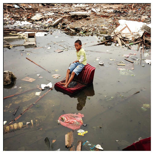
A child sits in a flooded district in central Jakarta, Indonesia. Forty percent of the city is below sea level resulting in frequent flooding.
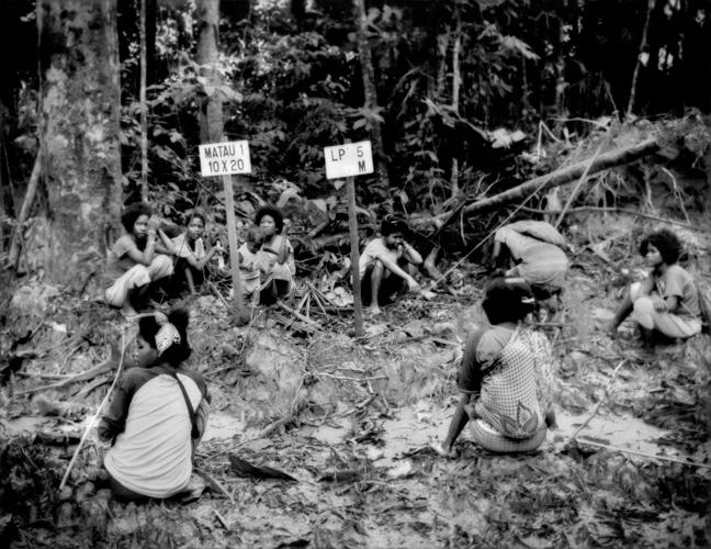
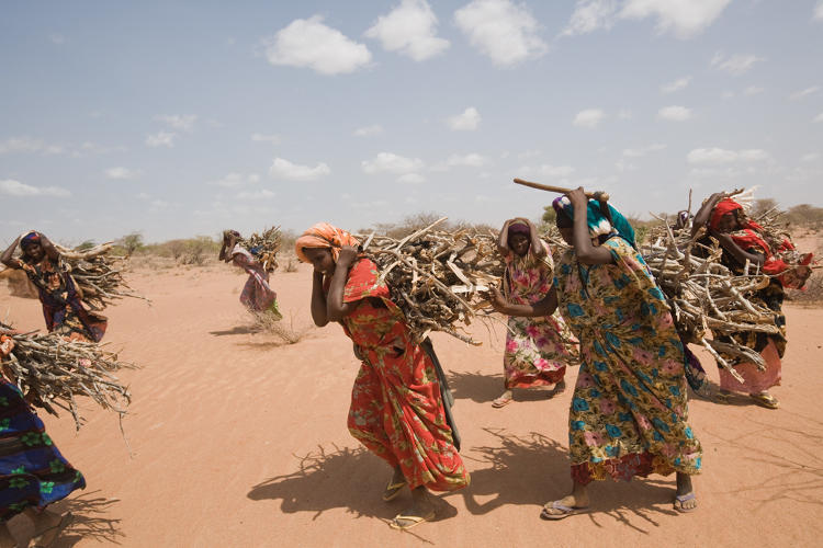
Batek Negrito women rest beside a muddy logging road in the heart of the Batek Negrito homeland that had been surveyed and marked for logging in the last, very narrow strip of old-growth rainforest that still existed, sandwiched between Taman Negara National Park and massive oil palm plantations. All the land here less than a generation ago had also been old-growth rainforest and the homeland of the Batek. Near Kuala Koh, Kelantan, Malaysia. Now this parcel of rainforest has also been clear-cut and terraced in preparation for a new oil palm plantation converting the most diverse ecosystem on the planet, a carbon sink absorbing greehouse gases, into a monoculture cash crop wasteland devoid of the wildlife upon which the Batek depend for sustenance.
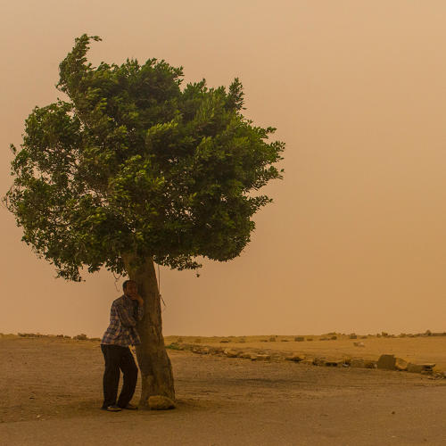
In this May 27, 2015, photo, a man takes cover under a tree in Mokkatam as a sandstorm and extreme temperatures grip Cairo. Today Cairo registered the highest temperatures on earth, officially a smoldering 46 degrees C (114 degrees F). It is unusual for Cairo to experience such extreme heat and a sandstorm of such magnitude in late May.
Muslims Ningxia
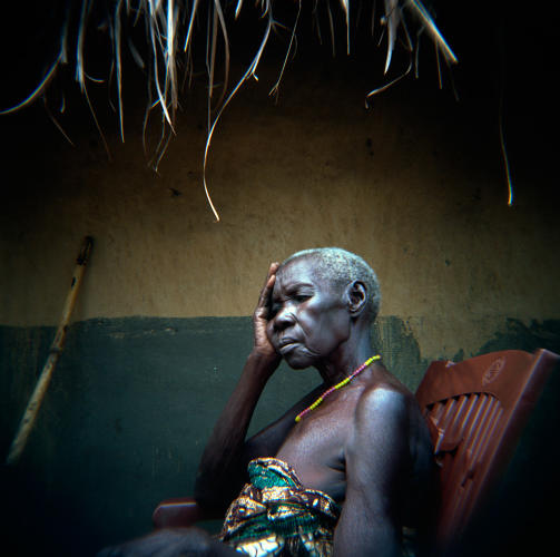
An elderly woman suffering from chronic intestinal illnesses sits in front of her home in South Sudan. Due to decades of conflict and unexploded ordinance left over from the war, her village, near the town of Yei, has no potable water or public services. Villagers take water directly from the river for drinking, washing, and cooking. In addition to living with the consequences of conflict, communities in the Horn of Africa must contend with the affects of climate change. According to the World Health Organization, “climate change is expected to affect the capacity of existing water and sanitation infrastructure and services. These services have to prepare for the widely anticipated consequences of floods and droughts, or risk compromising access to drinking water and adequate sanitation for substantial numbers of people in developing and developed countries, with cascading effects on human health and development.”
Yei, South Sudan. 27/06/2011.
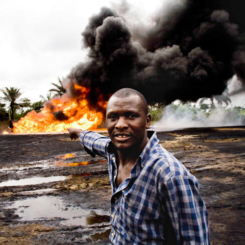
In the Ogoniland village of Kpean, an oil wellhead that had been leaking for weeks has turned into a raging inferno. The local youths keep watch, waiting for Shell to come and put the fire out. This is an environmental disaster for the local people, as it effects their crops, their water, and their air.
Even though Shell has not been allowed to pump oil from its 125 wells in Ogoniland since 1993, they sill have wells that are leaking and often unattended or maintained. This lack of action, which pollutes the lands and forces farmers and fishermen out of work, makes relations between the local communities and Shell very fractious. This Shell oil well is more than 30 years old, and this scenerio is typical of the kinds of ongoing problems with the oil works of the Niger Delta.

Fast Company , Read Full Story
(79)
