
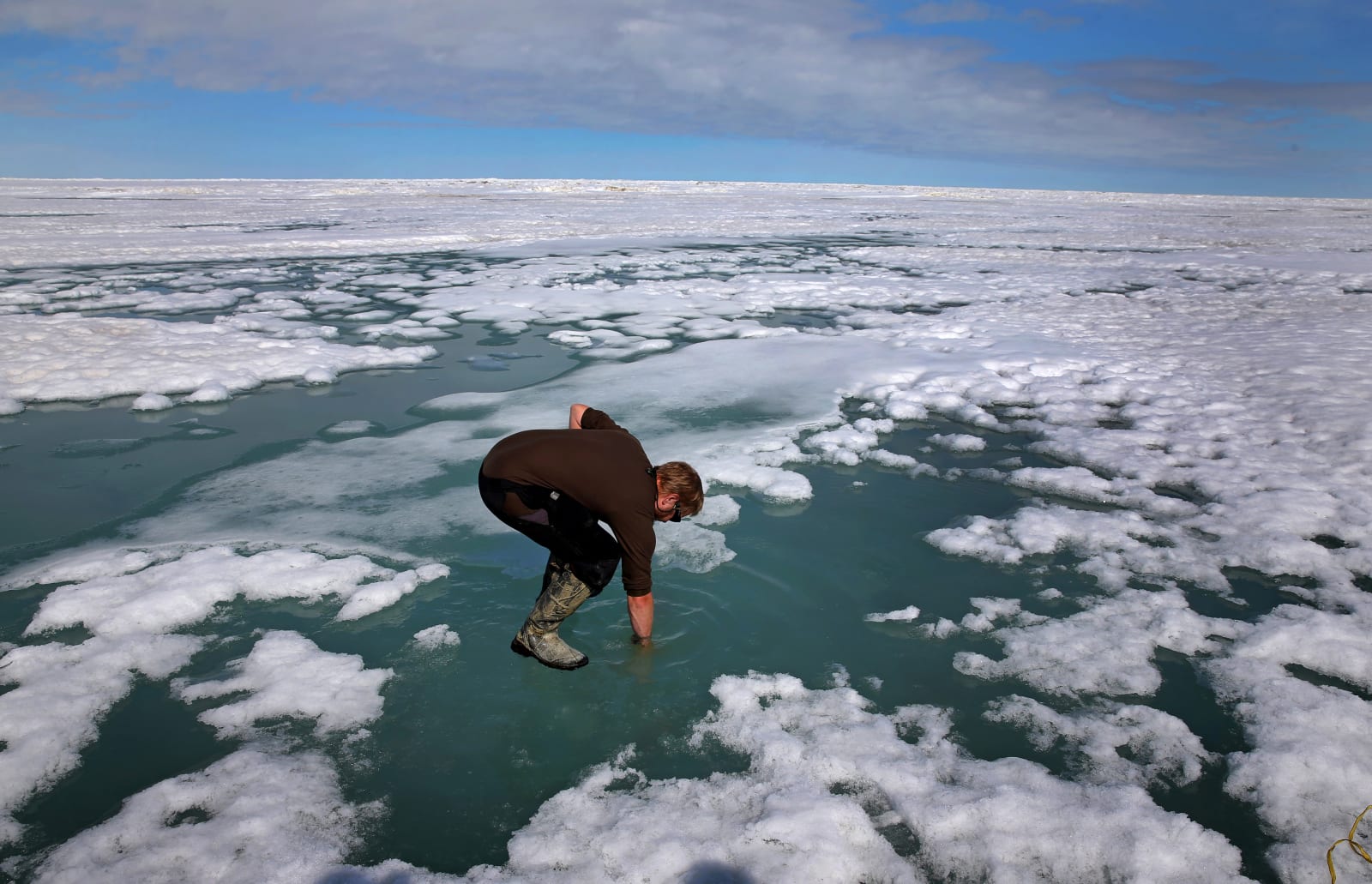
To protect the Arctic from climate change, scientists require a detailed map which they can slowly update and reference over time. Such a resource has, until now, been difficult to produce because traditional capture methods — low-flying aircraft, for instance — are expensive or ill-equipped to deal with the region’s harsh weather patterns. That’s now changed, however, thanks to a project spearheaded by the National Geospatial-Intelligence Agency (NGA) and the National Science Foundation. Following a directive from President Obama, the group has captured Alaska with a new level of clarity, using commercial satellites owned by Digital Globe.
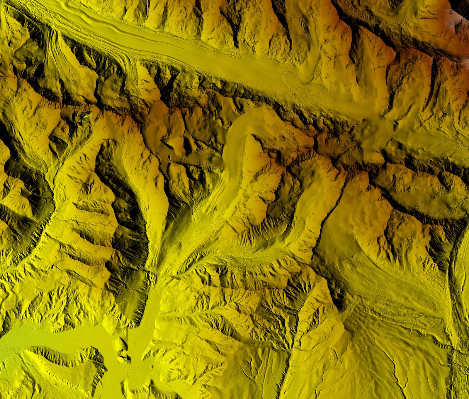
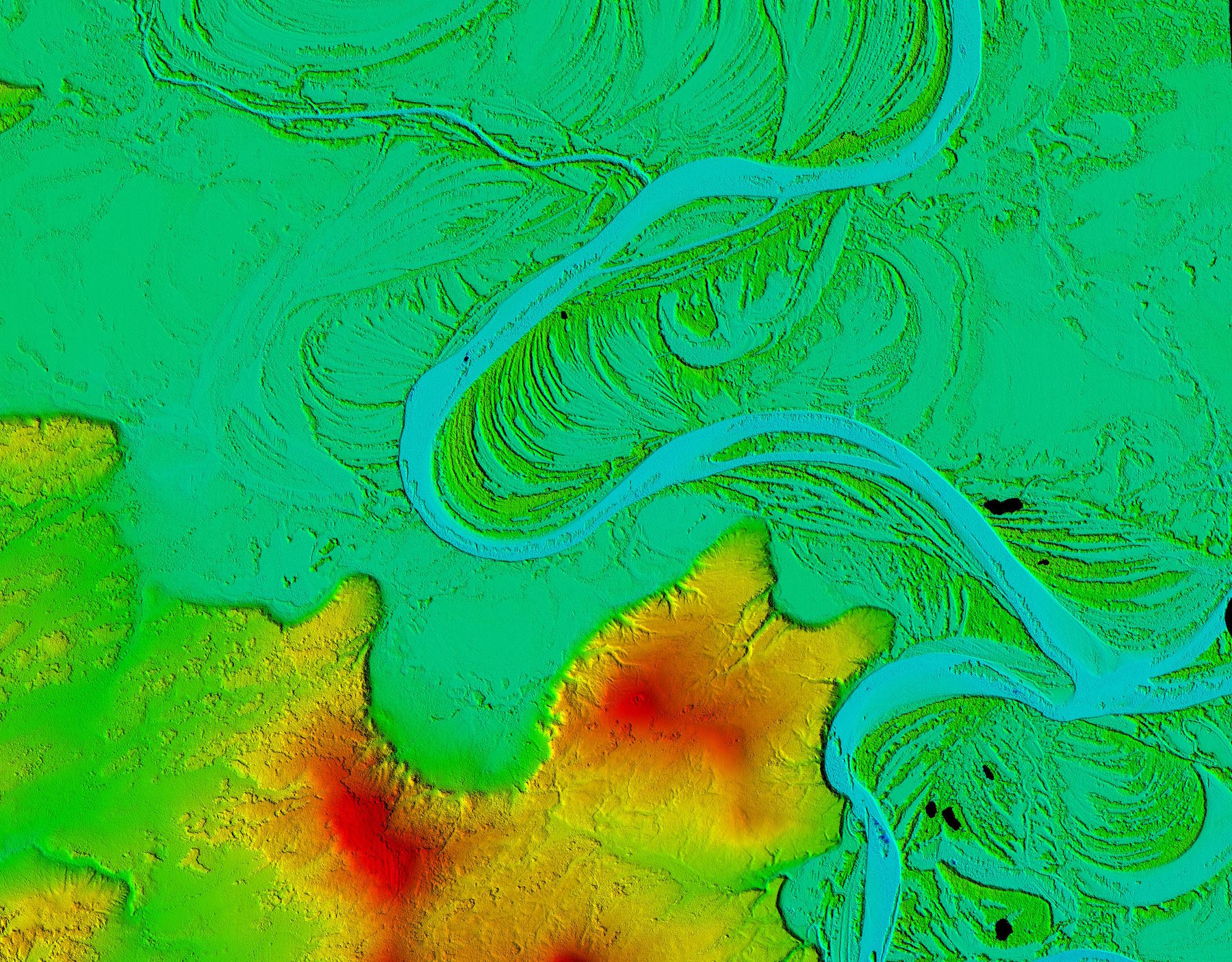
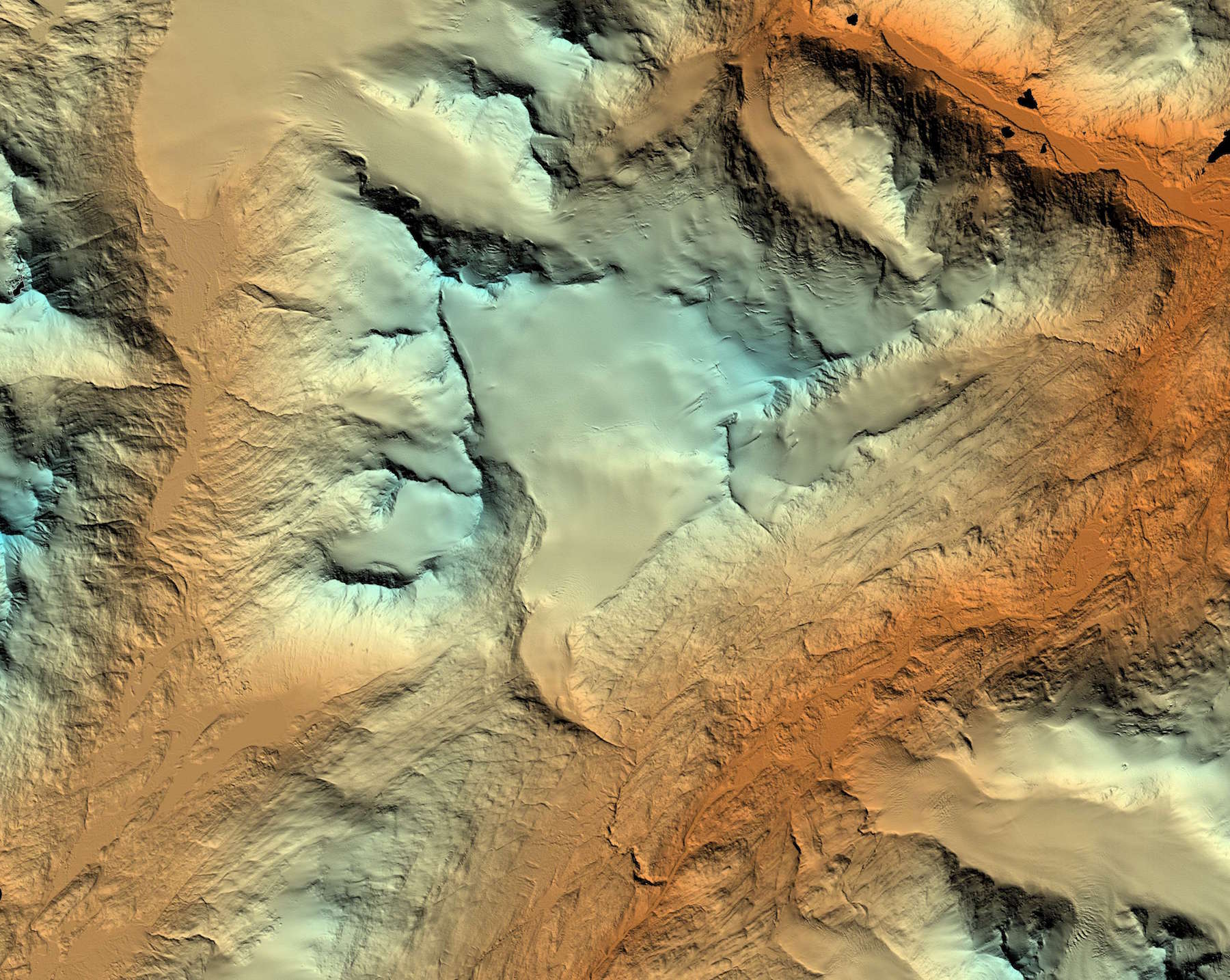
The three-dimensional topographic maps are based on 2-meter resolution images. The satellites captured the same location twice, 45 seconds apart, before sending them to a supercomputer which was able to combine them and extract elevation data. As National Geographic reports, this allows a horizontal resolution (the shortest distance at which a change in depth can be recorded) of 7 to 17 feet. Subtle height differences of less than two feet can be measured too, culminating in some detailed and insightful models.
Now that the Alaska map has been completed, the team is turning its attention to the rest of the Arctic. By 2017, it hopes to have a complete model — and a methodology — which can be easily replicated in the future. With the appropriate funding, a historical archive can be built up online, giving scientists everywhere a better understanding of the region. “The models will play an important role in informing policy and national security decisions,” NGA director Robert Cardillo said. “They may also provide critical data and context for decisions related to climate resilience, land management, sustainable development and safe recreation.”
The best part of all? The complete dataset, known as ArcticDEM, is freely available to view online. So whether you’re planning a trip or merely curious to see the breathtaking terrain up close, it’s only a URL away.
(24)