From one parking spot to 100 public parks: The history of San Francisco’s street transformation
In 2005, a San Francisco collective of artists and designers called Rebar ignited a global street intervention, which later became known as Park(ing) Day.
“We observed that 70% of the right-of-way was allocated to vehicles, while only 20% or 30% was for people on foot or bike,” said John Bela, one of Rebar’s founders. “That just seemed like an imbalance.”
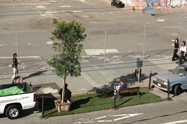
The group decided to reclaim a small piece of the road. On a sunny weekday morning in November, Rebar members fed a downtown San Francisco parking meter and set up a temporary park with grass, a bench, and a young bay tree. There the park remained for two hours until the meter ran out. They rolled up the sod, packed away the bench and the tree, gave the spot a sweep, and left. “When people sat down on the bench and began having a conversation, we realized it was a success,” Bela recalled.

[Photo: John Bela/courtesy Island Press]
Rebar wasn’t the first to reclaim San Francisco streets for pedestrians. Artist Bonnie Sherk had introduced portable parks under freeway overpasses and alleyways in the 1970s. But in 2005, the idea took off. Flooded by requests from other cities, Rebar published an open-source how-to manual empowering others to create their own installations. Many people were eager to see cities change, and Park(ing) Day allowed them to take this process into their own hands. Park(ing) Day is now an annual open-source global event, a day when people take back parking spots to make spaces for people in hundreds of cities all over the world.
By 2009, cities across the United States were finding inventive ways to reclaim city streets with tactical experiments using quick, low-cost methods. These increasingly common practices became known as “tactical urbanism.” Street interventions were not just the creation of guerrilla artists and activist planners; they were the work of transportation agency directors and mayors.
The introduction of New York City’s plaza program, including closing Times Square to traffic, set a new bar for cities. Inspired by Park(ing) Day, the San Francisco Planning Department began an official program repurposing parking spaces into what they called parklets. By design, parklets are temporary microparks, permitted with one-year renewable permits; they usually occupy one to three curbside parking spaces.
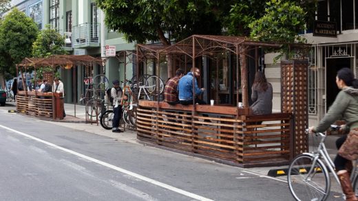
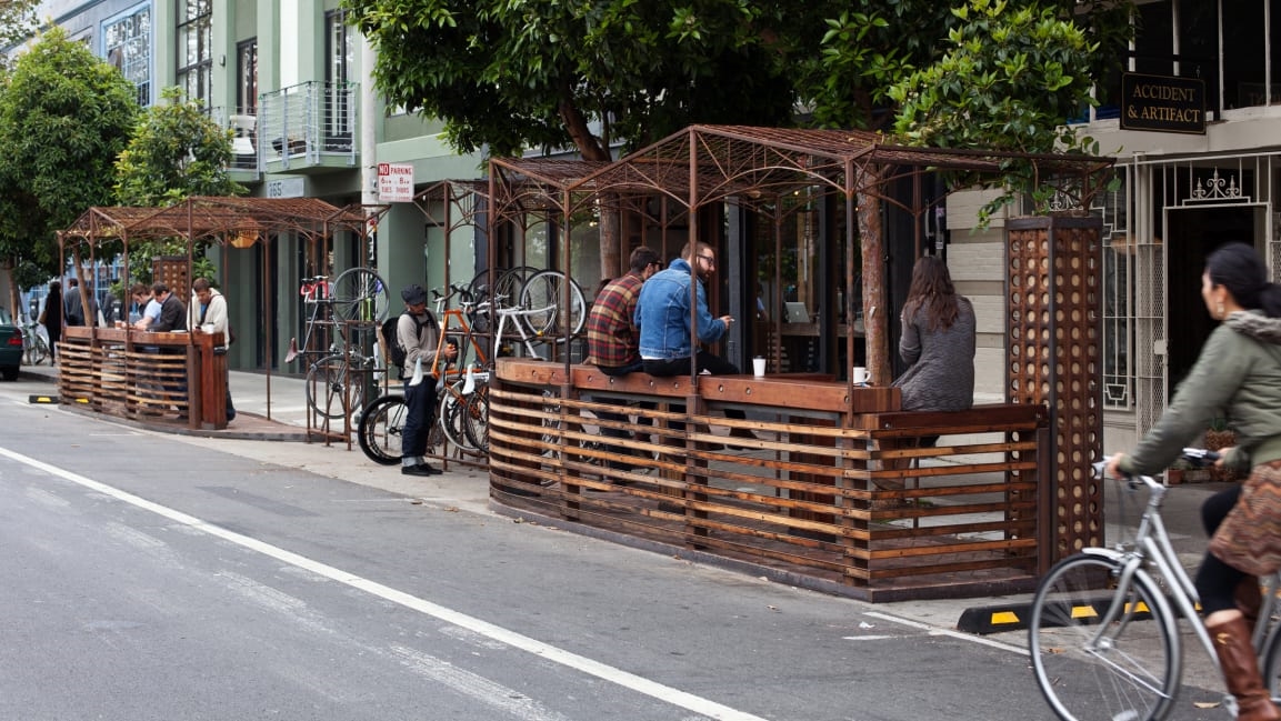
Parklets often include seating areas, planters and greenery, bike racks, and café tables, but in contrast to more typical restaurant patio or sidewalk seating areas, parklets are public spaces. They are an extension of the sidewalk into the parking lane and offer a fast, inexpensive way to create much-needed open space on city streets.
Rebar strongly advocated for parklets to be public, and today each has a small sign indicating that seating and amenities are open to all. Parklets are constructed and maintained by residents and local businesses in public-private partnerships with the city’s Planning Department.
Robin Abad-Ocubillo, the director of Shared Spaces at San Francisco Planning, ran the parklet program for 10 years after his tenure at the Golden Gate National Parks Conservancy. Working in parks gave him an appreciation of their democratic influence. “Our shared open spaces are the venue and the vehicle for connecting us as individuals across class, race, and other demographic divisions. They cultivate civic engagement and our sense of stewardship,” he said.
These principles could be applied not only to San Francisco’s large parks, but to the small ones as well. Abad-Ocubillo and his colleagues envisioned the 25% of city land given up to roads as the perfect site for a new park system. Since the parklet program began, close to 80 parklets have been installed, turning more than 100 parking spaces green across the city and inspiring similar programs worldwide.
However, the biggest expansion of the program came during the COVID-19 pandemic when, as an emergency response, a version of parklets was initiated as the Shared Spaces program. Within one year, close to 2,000 applications were approved, transforming many of the city’s commercial corridors and supporting the operation of businesses during the pandemic.
Despite the open-space benefits of parklets, their design-heavy execution by upscale coffee shops and restaurants associated them early on with the forces of gentrification and displacement. They have been called “utopian window dressing on gentrifying development plans.”
San Francisco is one of the most expensive and challenging housing markets in the United States. Minimum-wage workers must work more than four full-time jobs to afford a two-bedroom unit in the city. The Mission District, which is home to at least 15 parklets, has become a symbol of these forces. With the city’s highest eviction rate, the neighborhood is steadily losing its long-term Latinx population and has the third highest rates of unhoused people in the city.
Bela, once a resident of the Mission, rejects this view.
“In the Mission, along the 24th Street corridor, they didn’t want parklets, as they saw them as vectors of gentrification,” he said. “However, gentrification and displacement are a bigger structural issue of systemic inequality that shouldn’t be conflated with access to safe sidewalks, public transit, and a quality public realm in that neighborhood. How many cycles of disinvestment are we going to allow before we address these systemic causes? It’s critical that any public space investment be distributed equitably throughout the city.”
As a planner, Abad-Ocubillo sought to guide the parklet program to invest in communities, not just commerce.
“We emphasized technical assistance and outreach to parts of the city that needed extra support because of our legacy of neighborhood disinvestment, including less well-provisioned park spaces,” he said. “We diversified the composition of parklet sponsors to include cultural institutions such as art galleries, youth development organizations, and educational institutions that could experiment with programming public space.”

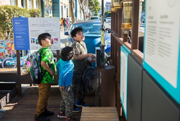
[Photo: Amy Snyder/Exploratorium/courtesy Island Press]
Swissnex created the Event Machine parklet, which hosted film screenings, panel discussions, and workshops. A Mission District gallery used its parklet for rotating art exhibitions. A progressive science museum called the Exploratorium created Ciencia Pública, in collaboration with the Boys & Girls Clubs of San Francisco, and installed it outside the Buena Vista Horace Mann Community School as an outdoor lab for science classes.
San Francisco has even experimented with installing bathrooms in parking spots, such as the P Planter designed by Hyphae Design Laboratory, which uses plants as biofilters to treat urine and wastewater, aiming to solve the problem of public urination. The trial contributed to the Public Toilet Project master plan in the Tenderloin neighborhood.
It is not just parking spots that have been reclaimed in San Francisco, but entire streets. With growing recognition of the public appetite to create public spaces, city officials built upon the parklet program and other public space experiments to create the Places for People Program in 2016.
This inter-agency permitting framework aims to lower the barriers to participation for all the city’s communities. It integrates permitting processes for curbs, sidewalks, streets, and lots into one public space program called Groundplay. With the tagline “When imagination goes public,” the program intends to enable a fast-paced grassroots process that promotes resident initiatives to create and activate inventive public spaces on sidewalks, curbsides, roadways, crosswalks, and public parcels.
Jodie Medeiros, executive director of Walk San Francisco, said that “experiments like Park(ing) Day, parklets, and Groundplay have enabled us to do a lot more with city streets. These pilots go even a step further with car-free streets.” Now these tactical approaches are being used to retake roadways with Vision Zero quick-build projects deployed to help make San Franciscans safer from the threat of speeding cars.
In January 2020, San Francisco realized a long-envisioned goal of eliminating cars from 10 blocks of its central commercial corridor, Market Street. Improvements at intersections were installed to make the street safer for pedestrians and cyclists. Within the first two months, bike and scooter usage increased by 25%, and bus travel speeds went up an average of 6%.
When the pandemic hit, the city expanded car-free streets by deploying a 45-plus-mile network of slow streets, supporting walking and biking. In March 2021, Mayor London Breed announced legislation to transition Shared Spaces from an emergency response into a permanent program, helping to move San Francisco more aggressively toward the goal of making pedestrians safe.
From From the Ground Up by Alison Sant. Copyright © 2022 Alison Sant. Reproduced by permission of Island Press, Washington, D.C.
(24)


