Uber drivers will soon get a much clearer picture of their next customer.
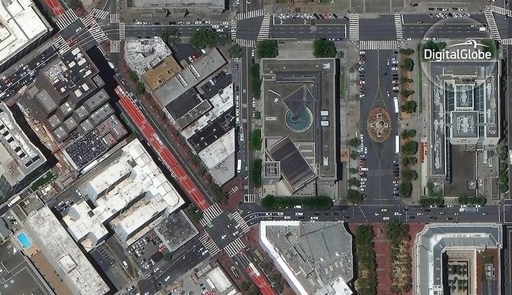
The ride-sharing service will use high-resolution satellite imagery from DigitalGlobe to “help identify and improve pickup and drop-off locations.” Under a new multi-year partnership, Uber can leverage DigitalGlobe’s system of sensors to “improve the … experience for riders and drivers around the world.”
“Uber is revolutionizing transportation by making the experience dead simple,” Kevin Bullock, director of business development at DigitalGlobe, wrote in a blog post. “We are thrilled to be joining them in that revolution.”
The Colorado-based company in 2014 persuaded the US Department of Commerce to drop image-resolution restrictions on private satellites. As a result, DigitalGlobe launched its WorldView-3 satellite, which can detect images as small as 12 inches across.
“We’ve spent the last decade developing advanced technology that scans the Earth with the highest accuracy and resolution,” Bullock boasted. “This capability gives our customers an unprecedented ability to understand the environment in which they operate, and in turn, to create new and disruptive services that change the way we live.”
This deal will further expand Uber’s mapping efforts, which got a boost in 2015 when the ride-hailing company bought mapmaker deCarta, only a few months before acquiring some of Microsoft’s Bing map tech (and about 100 employees).
Eagle-eyed passengers, meanwhile, spotted branded Uber SUVs roaming the streets last year, collecting imagery to improve app features like routing and ETA calculations.
Uber did not immediately respond to PCMag’s request for comment.
PC Magazine, Thursday, July 21, 2016
(53)
