The $1.9 trillion relief bill is only a start. Here’s how to ensure it’s distributed equitably
“The real challenge here is around the distribution of this crisis. It’s not just the scale, it’s the distribution, and the very uneven distribution of these challenges across the landscape,” says Joe DiStefano, CEO of UrbanFootprint, a data and mapping platform. “COVID has laid bare some pretty deep endemic inequities in our society related to resource distribution over the past decades and generations.”

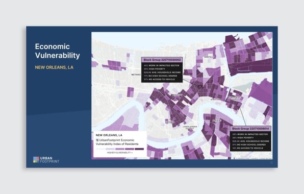
That makes trying to respond to these overlapping health and economic crises difficult. But DiStefano says that by understanding where these inequities manifest, whether in the form of eviction risk or food insecurity, governments and community organizations can get aid where it is direly needed. With the $1.9 trillion pandemic relief and stimulus package that’s moving through Congress this month expected to continue protections for households facing eviction or foreclosure, it will be essential to know where the problems are most extreme. UrbanFootprint’s database, with socioeconomic information on nearly all of the roughly 140 million land parcels across the United States, can help.
“This isn’t some multimillion-dollar, multiyear process to invent this kind of data,” DiStefano says. “This data exists. This is specifically what we’ve been building. And it can be used today, tomorrow, for this round of resource distribution, and for the next.”

The company, which got its start providing data and analysis for urban planning, real estate development, and mobility companies, combines open government data and commercial data sources to create detailed and regularly updated maps. During the pandemic, the company has shifted its focus to relief response, working with states like Louisiana to identify neighborhoods facing food insecurity. With millions of dollars in aid soon to become available across the country, the company is homing in on how to get aid where it’s needed most.
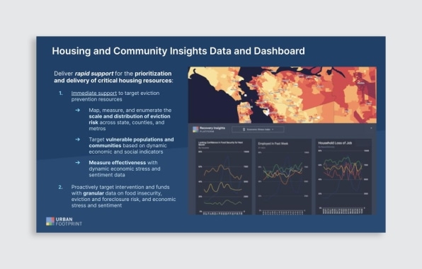
One example is eviction protections. DiStefano says the current system for getting help to those at risk is too imprecise. Money trickles down from the federal government to states and then to county agencies, which are then charged with either finding households within their community that are at risk or working with local organizations on the ground to distribute assistance—a process that sends out money before knowing where it should go.
DiStefano says UrbanFootprint’s database can filter down to identify areas most in need before the funding is distributed. It can look for all the multifamily housing within a specific community with elevated levels of jobless claims, for example, and refine to see which are owned by smaller companies or owners more likely to be affected by missed rent payments. Housing agencies and community organizations that receive this data can target their programs to offer aid and assistance information to those specific properties.

DiStefano says the approach also enables more assistance to get to people who might not realize help is available. “Some of those most vulnerable are not going to raise their hand for aid. They’re probably not going to even know that it exists. So states are going to have to go court and target these people in proactive campaigns,” he says. “What that does is help to design better interventions, design better outreach campaigns so people know about help, and ultimately to track the effectiveness of interventions. So if we can track down to the neighborhood level where eviction risk is greatest, then we can target limited resources to prevent eviction.”
This kind of mapping is one way to improve the efficiency of the large but ultimately limited relief package. DiStefano says it can be useful during this pandemic, but also in general. He says UrbanFootprint is in talks with several states about how its data can help with pandemic-related issues like eviction risk as well as longer-term issues like climate risk. There’s also a growing appetite at the federal level to improve the way aid is circulated.
“We’ve got a Biden administration right now that appears very open to utilizing data as a strong underpinning to distribute resources to those who need it most,” DiStefano says. “I think we have a once-in-a-generation opportunity to embed better insight into policy design, policy implementation, and policy monitoring.”
(33)


